You saw the footage of the August flood and now you are wondering: is Nepal safe to trek after the floods? It is a fair question, and the honest answer is not a simple yes or no. The flood was serious, but it was also concentrated in one corridor. Most of the country’s trekking regions sit in completely different river systems and valleys.
Is Nepal safe to trek after the floods? Yes, for most regions, but not for every route. Here is a region-by-region update on what was hit, what is open, and what to verify before you fly.
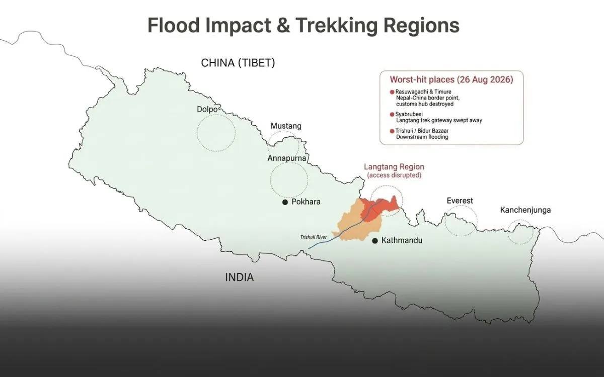
Map of Nepal flood impact and trekking regions, showing Langtang access disrupted
What matters now is your specific route, how you reach the trailhead, and what conditions look like on the day you travel. This guide walks you through each major region, using dated updates from official sources, so you can plan a safe and realistic trip this autumn.
Author’s Update Box
Last updated: October 2, 2026
Event covered: The August 26, 2026 flood along the Bhotekoshi and Trishuli river systems in Rasuwa.
Directly affected: The Rasuwa corridor, which includes the roads, bridges and settlements on the way to Langtang and Gosaikunda.
Access routes affected: The Batar–Dhunche–Syabrubesi road, used to reach Langtang, Gosaikunda and the Tamang Heritage Trail.
Needs extra verification: Manaslu and Tsum Valley (localized damage, later restored), plus any route that depends on the Rasuwa corridor.
Sources used: Trekking Agencies’ Association of Nepal (TAAN) September update and Nepal Tourism Board (NTB) update of September 11, 2026.
Note: Mountain and weather conditions can change quickly. Treat this page as a snapshot, not a guarantee.
Current situation: Nepal’s major trekking regions did not experience identical flood impacts. Some destinations remain accessible, while particular roads, bridges and approach routes were damaged or altered. Check your specific route and access corridor rather than treating the whole country as one destination.
What Happened in Nepal in 2026?
The August 26 flood
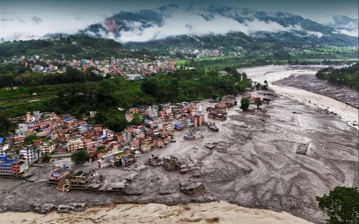
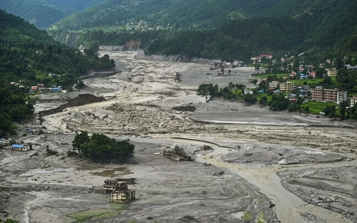
On the 26th of August 2026, a catastrophic flood inundated the Bhotekoshi River system and reached the Trishuli. The greatest devastation was seen in the Rasuwa district. Roads and bridges were partially destroyed or swept away, while villages and settlements were greatly damaged too. That corridor is the main route for trekkers to get to Langtang and Gosaikunda; thus, the news was alarming for many adventurers.
Mud and debris covering a Nepal town after the August 2026 flash flood
After that, the situation got even worse with international media coverage. Many articles talked about “Nepal floods” as if the whole Himalayas had been affected. This led to misunderstandings about trekking in the whole country.
Was the entire Nepal Himalaya affected?
No. Nepal’s trekking regions stretch across a huge east–west span, and they are geographically separate. Everest, Annapurna, and several other regions lie well outside the main disaster zone. TAAN’s September update identified Everest and Annapurna among the destinations not affected by the August floods.
Flood damage is not the same as a closed trail.
This distinction clarifies many misunderstandings. A damaged river, highway, local road, or bridge does not imply a damaged hiking trail. The trail, lodge, and route can each be in an entirely different condition. A route is only “closed” when it is closed, which can happen when there is a washed-out road while the trail is still fine. Keep these in mind as you read further.
Skip the one-word answer. Judge any route using five checks:
Trail condition:Is the actual trekking trail affected?
Access condition:Can you reach the trailhead by road or flight?
Weather condition:Is there heavy rain, snowfall, or landslide risk right now?
Infrastructure condition:Are bridges, roads, lodges, and communications working?
Official restrictions: Is there an active government or local advisory?
We use these same five checks for every region below.
Everest Region Safety Update
Everest Base Camp rock marker, showing the Everest region open for trekking after the flood
Everest Base Camp Trek
Current status:The August flood did not directly hit the Everest region the way it hit the Rasuwa corridor. TAAN named Everest among the destinations not affected by the August floods. That is good news, but it is not a promise that everything is perfect.
What to verify:Your access to Khumbu, including Lukla flights or alternative arrangements, and the latest weather. Flights into the mountains can be delayed by cloud at any time of year, so build in a spare day. The usual mountain risks, such as altitude and changing weather, still apply on this trail, flood or no flood.
The same logic covers the other Khumbu routes, including Gokyo Valley and the Three Passes. They were not in the flood zone, but each has its own altitude and weather demands.
Annapurna Region Safety Update
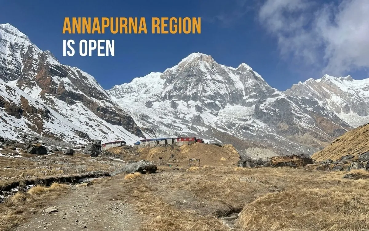
Annapurna region open for trekking after the flood, with Annapurna peaks and a trail
Annapurna Circuit Trek
Current status: Like Everest, the Annapurna region was geographically separate from the main disaster zone, and TAAN listed it as unaffected by the August floods. That also applies to popular shorter options such as Annapurna Base Camp, Ghorepani–Poon Hill and Mardi Himal.
The catch: “Not hit by the August flood” is not the same as “every road is safe today.” Access roads in this region can suffer landslides, heavy rain, and disruption on their own, independent of the flood. That is especially relevant on the long drive toward Manang and on the approach to Mustang. Ask your operator about the exact road you will use and have a backup day in your plan.
This is the one area where the flood directly changed trekking plans, so it deserves a closer look.
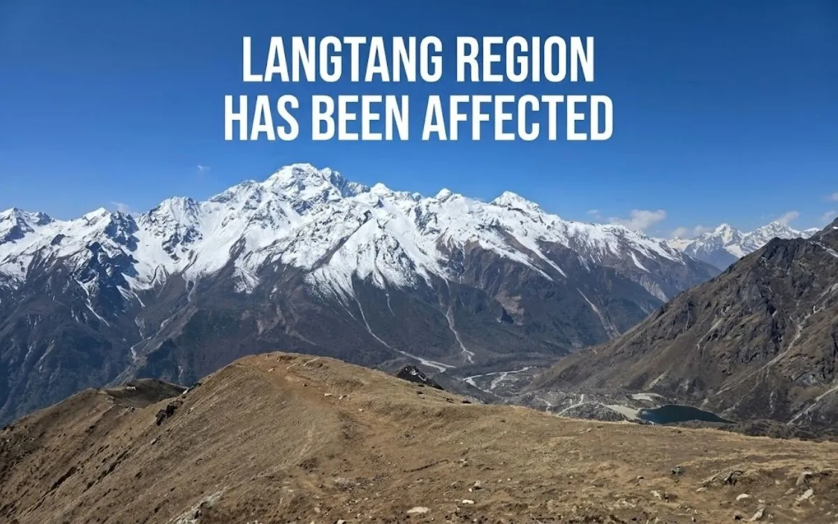
Langtang region mountains with text "Langtang region has been affected" after the Nepal flood
Langtang Valley Trek
What happened: The flood struck the Rasuwa corridor that leads to Syabrubesi, the usual starting point for Langtang. Roads and bridges on the approach were damaged.
What TAAN reported:The Langtang and Kyanjin Valley destination itself, along with Gosaikunda, was considered safe. However, the Batar–Dhunche–Syabrubesi road remained closed, so trekkers needed alternative access arrangements. To put it briefly, "normal road access is available" is not the same as "the trekking destination is safe."
Gosaikunda, the Tamang Heritage Trail and alternatives
Gosaikunda trekkers face the same access question as Langtang, so the route may need to change. TAAN’s reported alternatives include starting from the Kathmandu side near Sundarijal rather than driving to Syabrubesi. The Tamang Heritage Trail also begins in the affected corridor, so confirm its status before you commit.
What to verify:Which sections of road have actually been restored, whether your start point has changed, and whether your operator has a workable alternative itinerary. If any of these answers are vague, wait for clearer information.
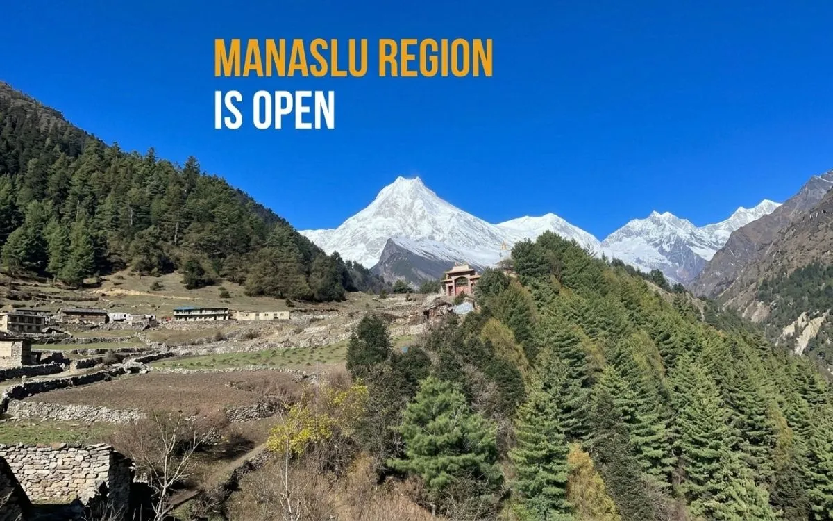
Manaslu region open for trekking after the flood, with snow peaks and a village
Manaslu’s story changed during September, so a timeline helps:
Initial damage:Localized flood damage affected structures along the route.
Temporary restriction: Trekking on the affected section was restricted.
Local restoration: Work crews repaired the damaged sections.
September 11 update: The Nepal Tourism Board said damaged structures around Namrung had been restored to a condition suitable for trekking, and the earlier restriction had been lifted.
That is a dated, official update, and it carries far more weight than an old blog saying “open.” Even so, it is a September snapshot. Confirm local conditions before departure, especially bridges and access on the Tsum Valley side.
Other Trekking Regions in Nepal
Nepal has many other trekking areas, and each one should be judged on its own. TAAN’s September assessment identified several of them as not affected by the August floods, including Kanchenjunga and Dolpo. Here is the quick view, using the same logic as above (flood impact, current access, trail status, and what to verify):
Kanchenjunga, Makalu and Rolwaling:No direct flood impact reported. Confirm roads, flights, and weather.
Dolpo, Dhaulagiri and Mustang: Remote and logistics-heavy. Check flights, road conditions,s and permits early.
Rara, Jumla and Far-Western Nepal: Far from the flood zone. Verify transport and flights.
Ganesh Himal and Ruby Valley: Closer to the affected area geographically, so check road access carefully.
Do not treat a September assessment as a permanent “safe” label. Always verify before you go.
Nepal Trekking After Floods Status Table: October 2026
Use this as a starting point. Every row shows when and by whom it was last verified, because statuses change.
Trekking region
August flood impact
Access situation
Trail status
Check before departure
Last verified
Everest
No direct impact reported
Verify current transport.
Verify current conditions.
Weather, access
Sep 2026 (TAAN)
Annapurna
No direct impact reported
Route-dependent
Verify locally
Roads, weather
Sep 2026 (TAAN)
Langtang
Significant regional impact
Access disrupted
Route-specific
Road and trail
Sep 2026 (TAAN)
Gosaikunda
Regional access impact
Alternative access may apply
Verify
Road and trail
Sep 2026 (TAAN)
Manaslu
Later localized flood damage
Restored section reported
Restriction lifted by NTB
Local conditions
Sep 11, 2026 (NTB)
Tsum Valley
Verify local conditions.
Route-dependent
Verify
Bridges, access
Not confirmed
Kanchenjunga
No August impact reported
Route-dependent
Verify
Weather, access
Sep 2026 (TAAN)
Dolpo
No August impact reported
Remote access
Verify
Logistics, weather
Sep 2026 (TAAN)
What Trekkers Should Check Before Departure
Trekking in Nepal rewards flexible planners. Before you go, work through this list:
Weather: Check the official forecast for your route and dates.
Flood and rainfall warnings: The Department of Hydrology and Meteorology (DHM) publishes rainfall and flood-monitoring information, including thresholds linked to landslide and high-flow risk.
Road to the trailhead: Confirm it is open for your vehicle type.
Bridges: Ask about any bridges on your route.
Lodges: Confirm that teahouses are operating.
Domestic flights: Check operations and keep a buffer day.
Local notices: Ask about local government announcements.
Your operator:Get current trail-level confirmation from your guide or agency.
Backup plan: Have a second itinerary ready.
Postponement trigger: Agree in advance on what conditions mean you delay or reroute.
Official Sources for Nepal Trekking Updates After Floods
Flood debris and damaged buildings in a Nepal river valley after the flash flood
Nepal Tourism Board (NTB): Tourism notices, route-specific updates, and tourist assistance. NTB set up dedicated help desks after the floods for information, coordination, and verified updates.
Department of Hydrology and Meteorology (DHM): Weather, rainfall, flood monitoring, and hydrological warnings.
District Administration Offices: Local road closures, trekking restrictions, and emergency information.
Tourist Police: Tourist assistance and emergency coordination.
Local trekking agencies and guides:The latest on trails, lodge availability, bridges, and roads.
Common Misconceptions About Trekking After the Flood
“All of Nepal was affected.” The disaster was geographically concentrated.
"The trek is accessible if the destination is safe." Even when the trail is in good condition, roads and bridges might sustain damage.
"October conditions are guaranteed by a September update." Infrastructure and weather are subject to change.
"The entire nation is represented by one region." The trekking areas of Nepal are geographically distinct.
"A blog that simply states 'open' is sufficient." Verify the route's status against current local or official data.
Safe Trekking Regions and Destinations in Nepal After the Flood
These regions were not directly affected by the August flood, according to TAAN’s September assessment. “Not affected” describes the flood, not today’s road or weather conditions, so treat this as a shortlist to verify, not a guarantee.
Everest region:Everest Base Camp, Gokyo Valley and the Three Passes lie outside the disaster zone. Confirm Lukla flights or alternative access and the weather.
Annapurna region:Annapurna Base Camp, Ghorepani–Poon Hill and Mardi Himal were not hit by the flood. Check the access road for landslides and rain, especially toward Manang and Mustang.
Manaslu Circuit:Localized flood damage was repaired, and the NTB lifted the restriction on September 11. Reconfirm bridges and local conditions before you leave.
Kanchenjunga and Dolpo: No August flood impact reported. Both are remote, so flights, logistics, and weather need extra planning.
Other regions: Makalu, Rolwaling, Dhaulagiri, Rara, Jumla and Far-Western Nepal are far from the Rasuwa corridor, but conditions on each route still need checking. Ask your operator for route-specific confirmation.
Currently Unsafe or Not Recommended for Trekking After the Flood
No trekking areas in Nepal have been deemed permanently closed. What is not recommended right now is travelling the standard routes through the damaged Rasuwa corridor without current, route-specific confirmation. The risk is in the access, not in the mountains themselves.
Standard road access to Syabrubesi: The Batar–Dhunche–Syabrubesi road was reported closed. Do not try to reach the Langtang trailhead independently or rely on pre-flood itineraries.
Normal Langtang and Gosaikunda starting points: Both depend on that same road. Go only with an operator who has confirmed a working alternative approach and a backup plan.
Tamang Heritage Trail: It begins in the affected corridor. Treat it as not recommended until your operator confirms access and bridges.
Any route with unverified bridges, roads, or lodges: If nobody can tell you the current condition with a recent date and a source, postpone or reroute.
This list can change quickly as repairs continue. If the road reopens or conditions worsen, the status of these routes changes with it, so check the latest NTB and operator updates before you book.
FAQs
Is Nepal safe to trekking after the 2026 floods?
For most regions, yes, but it depends on your route. While areas like Everest and Annapurna were not immediately impacted, the flood was centered in the Rasuwa corridor. Always check access and current conditions.
Is trek to Everest Base Camp safe in 2026?
The Everest region was not affected by the August flood. Normal mountain and weather risks still apply, so confirm flights and forecasts before you travel.
Is the Annapurna Circuit open after the flood?
The region was not hit by the August flash flood. Road conditions can still change because of landslides and rain, so confirm the specific access road with your operator.
Is the Langtang Valley Trek open after the Rasuwa flood?
The valley itself was considered safe by TAAN, but the normal road to Syabrubesi was closed, so you need alternative access arrangements. Get a current update before booking.
Is the Gosaikunda trek safe in 2026?
TAAN considers the destination safe, but access follows the same disrupted corridor. An alternative approach may apply, so verify with your operator.
Is the Manaslu Circuit open in 2026?
Yes, according to the NTB’s September 11 update, which said the earlier restriction had been lifted after restoration near Namrung. Reconfirm local conditions before departure.
Which trekking regions were affected by the flood?
The Rasuwa corridor was the main impact zone, affecting access to Langtang and Gosaikunda. Manaslu had localized damage that was later restored. Most other regions were not directly affected.
Are the roads to Nepal’s trekking regions open?
It varies by route. Some roads are normal, while the Batar–Dhunche–Syabrubesi road was reported closed. Ask your operator about your exact road.
Can I trek in Nepal in October 2026?
Yes, in many regions, as long as you choose your route carefully and verify access, weather, and local advisories first.
Where can I get the latest Nepal trekking updates?
Start with the Nepal Tourism Board, the Department of Hydrology and Meteorology, district administration offices, the Tourist Police, and your trekking operator.
Simple and easy to communicate with local trekking and tour operators like us at Himalayan Recreation Treks and Expedition team.
Final Assessment: What Trekkers Should Actually Do
Nepal is not a single yes-or-no answer, so use a simple framework:
Before booking: check the region.
Before travelling: check access.
Before starting: check the trail.
During the trek: monitor weather and local instructions.
If conditions deteriorate: follow local authorities and your guide.
To get real-time updates on Nepal, you can simply contact us at Himalayan Recreation, and we will help you choose the right trail for current conditions


-1.webp)


 based on 5 reviews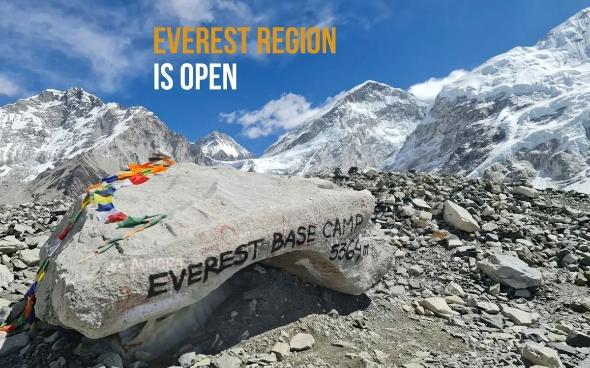





-1.webp)
-1.webp)
-1.webp)