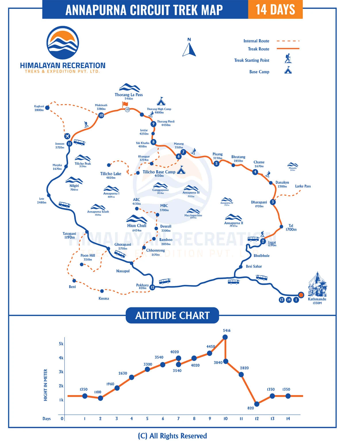
When you're getting ready for the Annapurna Circuit, knowing the trail layout makes everything so much simpler. Having a map of the Annapurna Circuit Trek lets you see the whole route, from the daily walking sections to the key villages, side trails, and mountain passes. Whether you're still planning or already out there trekking, a good Annapurna Circuit Trek map is a must-have for finding your way and scheduling those well-deserved rest days.
This guide is all about breaking down the Annapurna Circuit Trek map with distance. It gives you a clear picture of how much ground you cover each day and how the path shifts from lower valleys to higher alpine areas. The Annapurna Circuit Trek route map highlights important spots like Manang, Yak Kharka, Thorong Phedi, and Thorong La Pass. This helps hikers figure out where the altitude starts getting tougher.
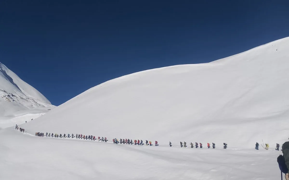
Long line of trekkers ascending snowy mountain pass on Annapurna Circuit trek in Nepal Himalayas
Moreover, the Annapurna Circuit Trek elevation map gives a good overview of how the altitude shifts along the route. It's crucial to have an idea of these elevation profiles to plan for acclimatization properly, especially when you're getting ready to tackle Thorong La Pass. By looking at the route, distance, and elevation maps in combination, hikers can get a better grasp of what to expect in terms of daily walking times, changes in altitude, and the general trail conditions.
The Annapurna Circuit Trek map shows a circular route of about 160 kilometers around the Annapurna Massif. People usually trek around the Annapurna Massif in a counterclockwise direction. You start off in the lower Marsyangdi River valley and then make your way up to a high Himalayan pass before heading down into the Kali Gandaki region.
Initial Trek Route (Besisahar to Chame): The trek begins at Besisahar or Bhulbhule and continues along the Marsyangdi River, through several villages, including Ngadi, Jagat, Dharapani, and Tal, ending in Chame, the administrative center of Manang District.
Trek from Chame to Pisang: From Chame, the trail goes up through pine forests and narrow river valleys to Lower Pisang and Upper Pisang, where the trail divides as there are two well-established routes to follow.
Route from Pisang to Manang: The trail leads to Ghyaru, Ngawal and Braga via the Western approach until you reach Manang village that may be considered as a major village and a place for the acclimatization of trekkers to the altitude.
Trek from Manang to Yak Kharka: After Manang the trail continues climbing steadily into the open alpine region, climbing through the villages of Tenki and Gunsang until you reach Yak Kharka, a grazing area located at a high altitude where there are several teahouses.
From Yak Kharka to Thorong Phedi/High Camp: The first part of the route gradually rises up to Ledar, then the incline steepens as it approaches Thorong Phedi or High Camp which are both final overnight locations right before crossing the pass.
Crossing Thorong La Pass to Muktinath: The highest point of the route is at the Thorong La Pass (5,416 m); the trail now goes downhill steeply and enters the Mustang area, finally arriving in Muktinath which is an important place for holy pilgrimages.
From Muktinath to Jomsom/Tatopani: The map indicates Jomsom as the next major location and shows the route going down from Muktinath to Kagbeni then traveling south along the Kali Gandaki gorge past villages called Marpha and Larjung and ending back at the main road toward Pokhara near the town of Tatopani.
Annapurna Circuit Trek Map With Distance and Walking Hours
Day
Route
Distance (Approx.)
Walking/Driving Hours
Elevation
Day 1
Drive from Kathmandu to Syange / Jagat
-
8–9 hrs drive
1,100 m
Day 2
Jagat to Dharapani
15 km
6–7 hrs
1,960 m
Day 3
Dharapani to Chame
16 km
6–7 hrs
2,630 m
Day 4
Chame to Pisang
14 km
5–6 hrs
3,300 m
Day 5
Pisang to Manang
15 km
5–6 hrs
3,540 m
Day 6
Acclimatization Day in Manang
-
Optional hikes
3,540 m
Day 7
Manang to Yak Kharka
10 km
4–5 hrs
4,020 m
Day 8
Yak Kharka to Thorong Phedi
7 km
3–4 hrs
4,450 m
Day 9
Thorong Phedi to Muktinath via Thorong La Pass
15 km
7–9 hrs
5,416 m / 3,800 m
Day 10
Muktinath to Jomsom
18 km
5–6 hrs
2,720 m
Day 11
Drive from Jomsom to Pokhara
-
8–9 hrs drive
820 m
Day 12
Drive from Pokhara to Kathmandu
-
6–7 hrs drive
1,350 m
Annapurna Circuit Trek Elevation Map and Major Altitude Changes
The Annapurna Circuit trek begins in the lower river valleys and continues to climb towards it’s highest elevation of 5,416 m at Thorong La Pass, then descends to the Mustang region. An elevation map allows trekkers to see where they will be gaining altitude each day, and what elevation they will need to adjust to, along with what sections will provide the greatest degree of difficulty.
Major altitude points along the trek
Besisahar (1,100–1,350 m): Starting point in the subtropical valley
Chame ( 2,630 m): First major climb through forested terrain
Pisang (3,300 m): High village in the Manang region
Manang (3,540 m): Key acclimatization stop
Yak Kharka (4,020 m): Alpine grazing area with teahouses
Thorong Phedi / High Camp (4,450 m): Last stop before the pass
Thorong La Pass (5,416 m): Highest point of the trek
Muktinath (3,800 m): Beginning of descent into Mustang
Jomsom (2,720 m): Common endpoint
Pokhara (820 m) : Final destination by road
Thorong La Pass Location on Annapurna Circuit Trek Map
On the trek, Thorong La Pass is found between Manang and Muktinath, represented as the highest elevation on the route (5,416 m). You can spot Thorong La on an Annapurna Circuit trek map using the following methods:
Check the altitude markers or contour lines: The highest point on the trail is marked with altitude markers/contour lines.
Follow the trail route: The trail climbs from Thorong Phedi/High Camp (4,450 m) to the pass then drops down to Muktinath.
Locate high pass, rest area, and teahouse symbols near Thorong La by referring to the map legend.
Some maps have grids or index labels to help trekkers accurately locate Thorong La Pass on their trekking maps.
Annapurna Circuit Trek Map Showing Villages and Overnight Stops
The map of the Annapurna Circuit Trek provides important information about the various villages along Nepal's famous Annapurna Circuit Trek, including the location of overnight stops. The major tea houses and lodges located along the trek have been clearly identified on the map, enabling trekkers to plan their daily hiking itinerary more easily and identify places to stop/rest. The trek begins in Besisahar and ends in Nayapul/Jomsom, depending on the route taken, with a wide variety of different terrain (subtropical forest to terraced farmland to high alpine valley) to cross.
Many of the important villages found on the Annapurna Circuit are clearly marked on the map, such as the villages of Bhulbhule, Jagat, Dharapani, Chame, Pisang, Manang, Braga, Thorong Phedi, Muktinath, and Tatopani. Each of these villages offers trekkers a number of different options for meals, lodging, and facilities for acclimatization. The map of the Annapurna Circuit Trek also indicates where to stop for the night in order to allow the trekkers to rest and acclimatize properly to the altitude changes, which can greatly enhance both safety and enjoyment.
Moreover, the trek map for the Annapurna Circuit contains information on both elevation and distance that aids trekkers in anticipating how many hours per day they will hike and how hard it will be for them. High-altitude towns such as Manang and Thorong Phedi, including their elevation profile, allows trekkers to plan days for acclimatization to decrease the chance of developing altitude sickness.
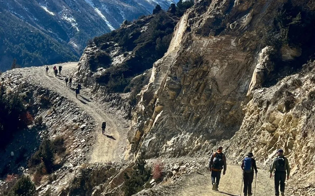
Trekkers hiking narrow mountain trail carved into rocky cliff face on Annapurna Circuit trek Nepal
Annapurna Circuit Trek Map With Road Sections and Jeep Tracks
On the Annapurna Circuit Trek map, you can see that there are parts where you can drive on roads and jeep tracks all the way to Khangsar village. As you trek from Besisahar to Jagat, Chame, and Manang, you'll come across a mix of walking paths and places where jeeps can go.
As you move past Khangsar, the road comes to an end, and you'll find yourself on a more traditional trekking trail heading towards Thorong Phedi, High Camp, and Thorong La Pass. Using the map can help you spot different road sections, pick alternative paths to walk, and organize your trek more effectively.
Annapurna Circuit Trek Map Including Side Trips (Tilicho Lake & Others)
The Annapurna Circuit Trek map features optional side trips such as a trail that leads to Tilicho Lake. This route connects to Khangsar, Shree Kharka and then continues on to Tilicho Base Camp, generally adding 2 to 3 extra days to your total trek. The trail has been clearly indicated on the trek map to assist trekkers in safely finding their way to Tilicho Lake.
Ice Lake (Kicho Tal) as well as Gangapurna Lake can also be found on the map and allow trekkers additional options for acclimatization hikes and opportunities for additional exploration within the vicinity of Manang.
Best Digital and Offline Maps for Annapurna Circuit Trek
Maps.me, Gaia GPS, and Trekking in Nepal are digital map applications that have map features that will help you navigate offline while hiking. Komoot will allow you to plan your hike and know what to expect before you leave for your hike.
In addition to digital maps found on these apps, always carry a physical map (1:25000 scale) from a publisher like Nepal Himalaya Maps or Himalayan Map House. GPS can commonly fail in remote areas, so always have a backup option with a physical map. By using both digital and physical maps, you will have multiple sources of information to help track your position, track elevation change, and plan when to stop along your trek at specific locations like Manang and Thorong La Pass.
How to Read and Use the Map on the Trail?
Before You Go: Familiarization
Map Types: Carry both physical waterproof maps and digital offline maps (Apps like Maps.me or Gaia) for backup and redundancy.
Symbols: Learn icons for villages, teahouses (lodges), water sources, bridges, monasteries (gompas), and cultural sites.
Contour Lines: Closely spaced lines indicate steep climbs or descents; widely spaced lines show flatter terrain. This helps gauge daily effort.
Elevation Profile: Note major altitude changes, especially the rise to Thorong La Pass (5,416 m), to plan acclimatization days in villages like Manang.
On the Trail: Using Your Map
Locate Yourself: Find a known landmark such as a river, bridge, or village and orient the map with your surroundings.
Track Progress: Follow the marked route and note distances between villages, for example, Chame to Pisang, to estimate walking time and energy required.
Plan Daily Stops: Identify teahouses (like Dharapani and Manang) for meals, rest, and overnight accommodation.
Anticipate Terrain: Use contour lines to prepare for uphill sections, such as the climb to Thorong Phedi, or steep downhill stretches.
Check for NATT Trails: Look for alternative blue-and-white “NATT” (New Annapurna Trekking Trails) that offer better scenery away from road sections.
Monitor Altitude: Keep track of elevation gain to avoid ascending too quickly and plan rest or acclimatization days as needed.
FAQs
Do I need a guide to use the Annapurna Circuit Trek map?
No, you don't need a guide in order to use the trekking maps. Both printed and digital Annapurna Circuit Trek maps are simple to follow. However, a guide can provide assistance with finding your way and keeping you safe while trekking, as well as help you learn about local culture, especially in the high elevation and isolated areas of the circuit.
Can I complete the Annapurna Circuit using only offline digital maps?
Many hikers successfully complete the Annapurna Circuit with the help of offline digital maps like Maps.me and Gaia GPS. While it is recommended that you also carry a physical version of the trekking map to use in case of battery failure or inadequate GPS signals, it is not required.
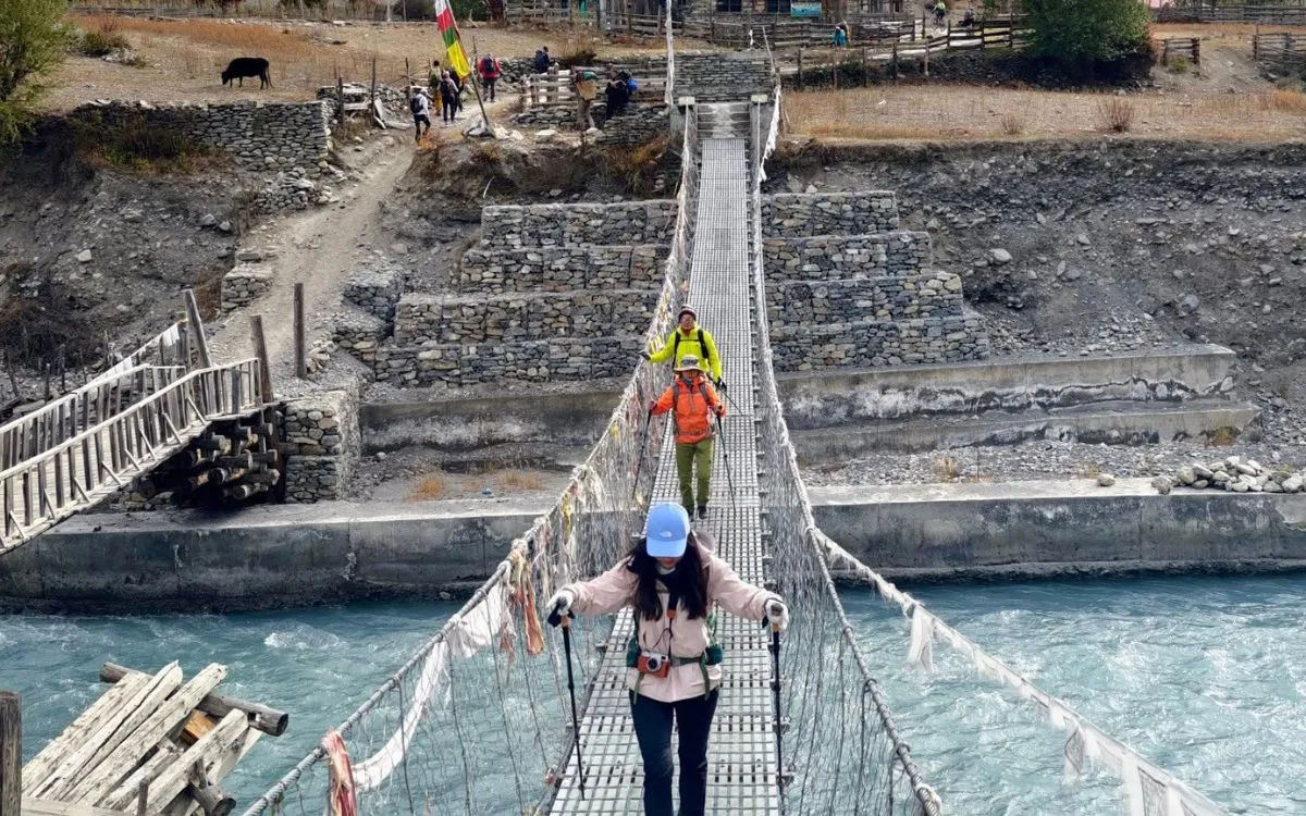
Trekkers crossing suspension bridge over turquoise glacial river in Himalayan village along Annapurna Circuit
Are Annapurna Circuit Trek maps accurate for current road conditions?
While many current trekking maps show large roads, jeep tracks, and trails, it is essential to remember that the technical difficulty of a road or trail may be different than what is represented on the digital map. Digital maps tend to be much more accurate than printed trekking maps, and therefore, hikers should always verify current updates before hiking.
Does the Annapurna Circuit Trek map show water sources and bridges?
Most trekking maps include the rivers, streams, and bridges that are on the hiking route. While hikers often find digital maps to be more detailed, the availability of water on the trekking route is often a seasonal factor, and therefore, as a hiker, you should plan accordingly.
Are villages and teahouses clearly marked on digital trek maps?
The annotated maps provided with the digital Annapurna Circuit Trek are useful because they show all of the teahouses, villages, and main overnight camping locations. This allows you to easily plan for your daily walking distances and places to camp each night.
Is the Annapurna Circuit Trek map useful for beginners?
The trek is an excellent resource for beginners. It gives you a clear idea of the overall route, the elevation gain, and the daily distances you will be walking. As a result, planning ahead and navigating the trail will be significantly easier.
Conclusion
The Map of Annapurna Circuit Trek is essential in preparing for an organized and safe trek. It provides trekkers with important details about their route, including daily distance covered, changes in altitude, which villages and where they will stay overnight on their trek. When overly used, together with distance and elevation maps, trekkers will plan for the appropriate time along their trek, prepared for altitude gain, and prepared for correct acclimatization points, such as Manang and Yak Kharka.
Annapurna Circuit maps also clearly show sections of road, jeep tracks, and potential side trips (for example, Tilicho Lake), allowing trekkers to easily prepare their itinerary. Whether you are using an electronic map or an old-fashioned printed trekking map, by learning how to read your trekking map, you gain more confidence and improve the safety of your trek, especially when crossing Thorong La Pass.
If you need assistance with planning your trek or want to receive expert guided services for your trek, please contact Himalayan Recreation.
-14.webp)
-3.webp)
-2.webp)
-4.webp)