If you are going to Nepal, you must know Nepal offers some of the most famous high mountain passes in the world, making it a premier destination for adventure trekking. The mountain passes in Nepal act as the natural corridors connecting valleys, villages, and long-distance traverses across the Himalayas. For trekkers, crossing a high pass in Nepal represents a physical challenge and an opportunity to experience remote landscapes, inaccessible by any road.
Nepal has many routes that go above 5000 meters, from the mountain passes in the Everest region to those in Annapurna, Manaslu, and Mustang. Each Nepal high-altitude trek has its significance, some being part of well-known routes like the Everest Three Pass Trek, while others are part of cultural routes in Mustang or a more challenging route in Manaslu. Understanding the mountain passes altitude of Nepal will assist trekkers in their preparation and selecting the trek that suits them the best.
In this blog, we will explore the 10 highest mountain passes in Nepal, including information on their height, location, and connected trekking routes. This blog will provide you with important information about the most noteworthy Nepal trekking passes and the popular trekking routes that utilize the passes.
Kongma La Pass - Everest region
Altitude: 5,535 meters (18,159 ft)
Location: Everest region, Solukhumbu district
Starting Point: Chhukhung
Ending Point: Lobuche
Trekking Route: Part of the Everest Three Pass Trek
Kongma La Pass
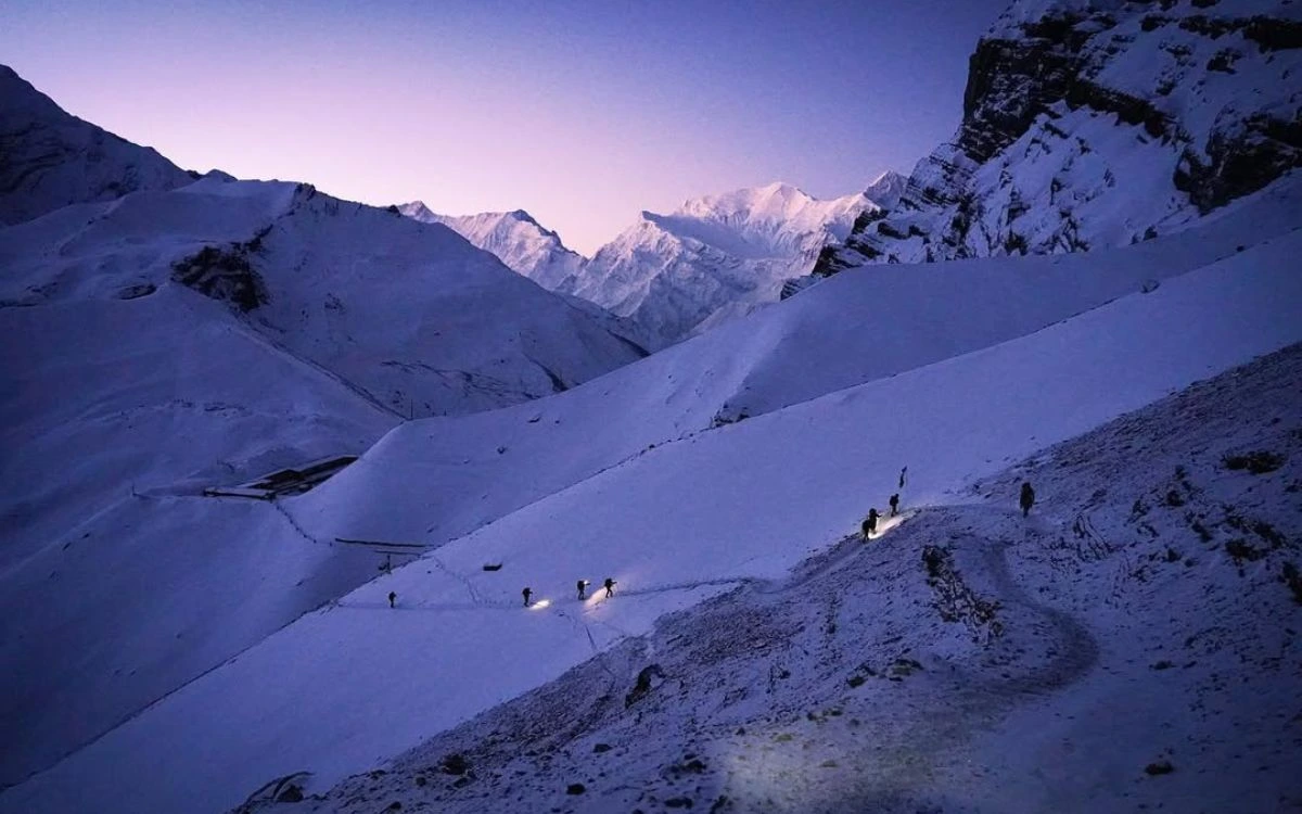
Kongma La Pass is among the highest mountain passes in the Everest region. It is situated at an elevation of 5,535 meters (18,159 feet) and is part of the Everest Three Pass Trek. Crossing Kongma La is a tough but necessary achievement on the three pass trek since it is the connecting route linking Chhukhung valley to the west, to Lobuche in the east.
The Everest Three Pass trek itinerary takes about 18 to 22 days to complete the trek of 60 to 70 kilometers (37–43 miles) depending on your route and the extent of your side trips. Kongma La is located between the peaks of Amphu Lapcha (5,888m/19,324ft) and Kongma Tse (5,849m/19,188ft). Depending on the variation of your chosen route the trail will take you through glaciers, snowfields, and high altitude rocky terrain.
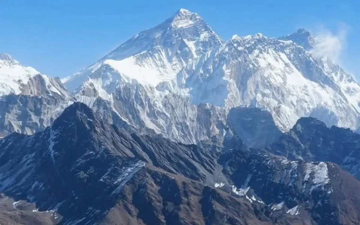
The views from the Kongma La are incredible. Trekkers will get to admire surrounding peaks, such as Mount Everest, Lhotse, Nuptse, Ama Dablam, and Island Peak. Trekking in high altitudes puts you at risk of altitude sickness, so being aware, and tempted to take your time and properly acclimatize is important.
Cho La Pass – Everest region
Altitude: 5,420 meters (17,782 ft)
Location: Solukhumbu district, Everest region
Starting Point: Dzongla
Ending Point: Lobuche
Trekking Route: Everest Three Pass Trek
Difficulty: Moderate to challenging
Best Season: March to May, September to November
Cho La Pass
Cho La Pass is the other significant highest mountain pass in Nepal, Everest region. At an elevation of 5,420 meters (17,782 feet), it is an integral part of the Everest Three Pass Trek. The pass links Dzongla village in the west with Lobuche in the east, and represents one of the most stunning and fulfilling sections of the trek.
The Everest Three Pass Trek, including Cho La, usually takes around 18 to 22 days to complete, whilst covering around 60–70 kilometers (37–43 miles). The cho-la is located between glaciated peaks, and you will be on a rocky and icy trail. Along the way, trekkers will cross moraine fields and glacial streams while traversing high-altitude terrain. Teahouses and lodges near Dzongla and Lobuche provide places to rest, eat and sleep on this section of the trek.
At the top of Kongma La, trekkers are treated to expansive views of the Himalayas, including Ama Dablam, Lhotse, Makalu, Pumori, Everest and Island Peak. The Kongma La pass connects with valleys in which trekkers can locate teahouses, small villages, and culturally engage with Sherpa communities.
Renjo La Pass – Everest region
Altitude: 5,360 meters (17,585 ft)
Location: Solukhumbu district, Everest region
Starting Point: Gokyo
Ending Point: Thame
Trekking Route: Everest Three Pass Trek
Difficulty: Moderate to challenging
Best Season: March to May, September to November
Renjo La Pass
Renjo La Pass is situated at 5,360 meters (17,585 ft) in the Everest region and is one of the three passes of the Everest Three Pass Trek. Renjo La connects the Gokyo Valley and the Thame Valley, providing an alternative route between two of the less crowded areas of Khumbu. Trekkers cross Renjo La after trekking the beautiful turquoise Gokyo Lakes, which is often a highlight during their trek to EBC.
The trail to Renjo La itself is very steep and long. There are stone steps, rocky conditions and depending on the season, there could be some snow. It may not be technically challenging like Cho La or Kongma La, but it is very steep and requires acclimatization and stamina. It is common for trekkers to leave Gokyo to cross Renjo La and continue to the Sherpa village of Thame, allowing trekkers to experience a more authentic mountain culture away from the more crowded route to Everest Base Camp.
The view from the top of Renjo La is one the best in the Everest region. From the top, you see Mount Everest, Lhotse, Makalu and Cho Oyu along with the brilliant chain of Gokyo Lakes below. The Renjo La Pass is not like many other passes that are too large to allow for Himalayan views.
Thorong La Pass – Annapurna region
Altitude: 5,416 meters (17,769 ft)
Location: Mustang and Manang districts, Annapurna region
Starting Point: Manang
Ending Point: Muktinath
Trekking Route: Annapurna Circuit Trek
Difficulty: Moderate
Best Season: March to May, September to November
Thorong La Pass
Thorong La Pass at 5,416 meters (17,769 ft) is generally considered the most famous trekking pass in Nepal and is the highest altitude of the Annapurna Circuit Trek. Thorong La connects the two valleys of Marsyangdi (Manang) with that of Kali Gandaki (Muktinath), forming the natural link between the lushness of the northern Annapurna region and the aridity of the Mustang. Most trekkers will spend a few extra days acclimatizing in Manang before attempting the pass so that they can more safely deal with the altitude.
Essentially, from either Thorong Phedi or High Camp, trekkers will encounter a twisting climb from rocky paths including small stream crossings and the occasional snowfield along the way to the top. However, that said, the trek isn't technically challenging - it's simply very long and at high altitude, thus making it physically demanding.
Once at the top, the trekkers will have a panoramic view of Annapurna II, Gangapurna and Dhaulagiri and of the surrounding Himalaya valleys. The trek then continues downhill to Muktinath, a monument to both Hindus and Buddhists, providing more to the experience.
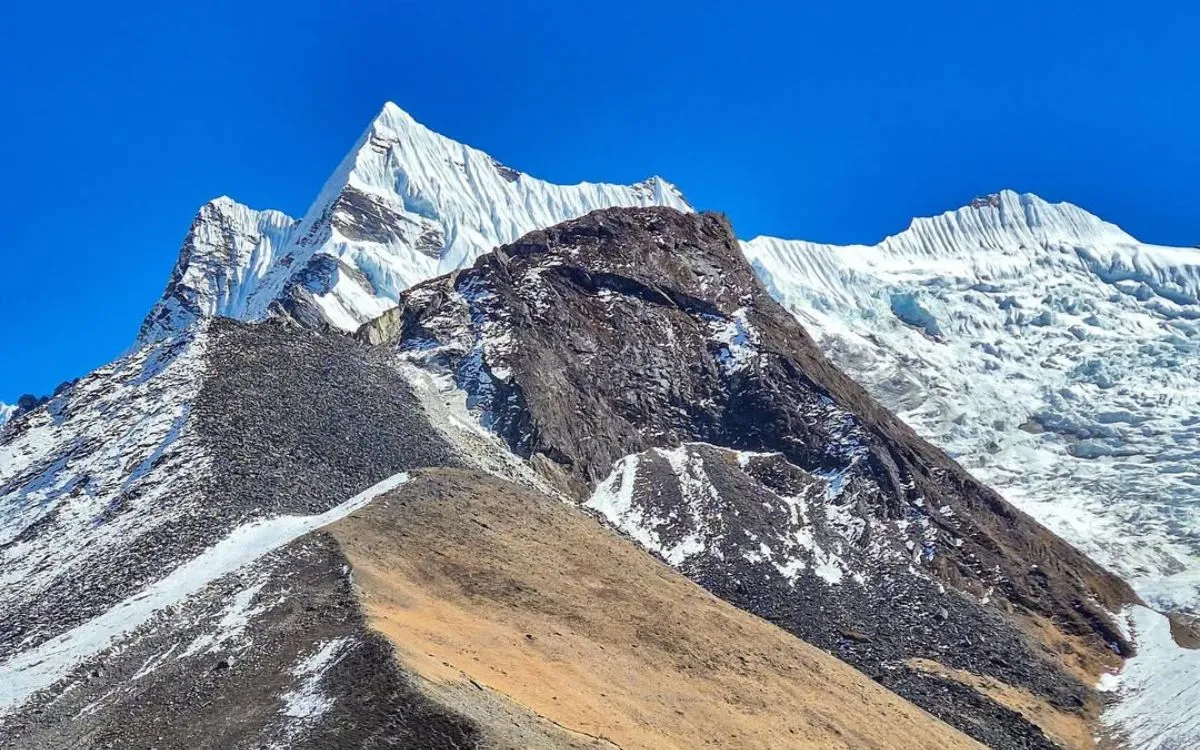
Larkya La Pass – Manaslu region
Altitude: 5,106 meters (16,752 ft)
Location: Gorkha district, Manaslu region
Starting Point: Samagaon
Ending Point: Bhimtang
Trekking Route: Manaslu Circuit Trek
Difficulty: Moderate to challenging
Best Season: March to May, September to November
Rising to 5,106 meters (16,752 ft), Larkya La Pass is the high point of the Manaslu Circuit Trek. The pass situated between Samagaon and Bhimtang provides an important link between the isolated upper valleys of Manaslu and more accessible trekking routes through the lower valleys. Most trekkers spend several days acclimatizing in villages like Samagaon before even thinking of the Larkya La Pass; the elevation and distance are demanding.
The trail to Larkya La is likely to be rocky trail, glacial moraines or other variable conditions (depending on the time of the season); it is steep and may take trekkers between 7-10 hours to cross from Dharmasala (Larkya Phedi) to the other side of the pass.
At the top, trekkers will appreciate a grand view encompassing peaks such as Himlung Himal, Cheo Himal, Kang Guru, and Annapurna II at the Larkya La top. You can also choose to spend time at Larkya La if you have acclimatized and take in the full experience. On the other side of the pass, trekkers will descend into greener valleys, with villages that carry imported aspects of Tibetan culture and wealth of experience for visitors.
Mesokanto La Pass – Annapurna region
Altitude: 5,099 meters (16,729 ft)
Location: Annapurna region, near Tilicho Lake
Starting Point: Tilicho Base Camp
Ending Point: Jomsom
Trekking Route: Tilicho Lake to Jomsom route
Difficulty: Challenging
Best Season: April to May, October to November
Mesokanto La Pass
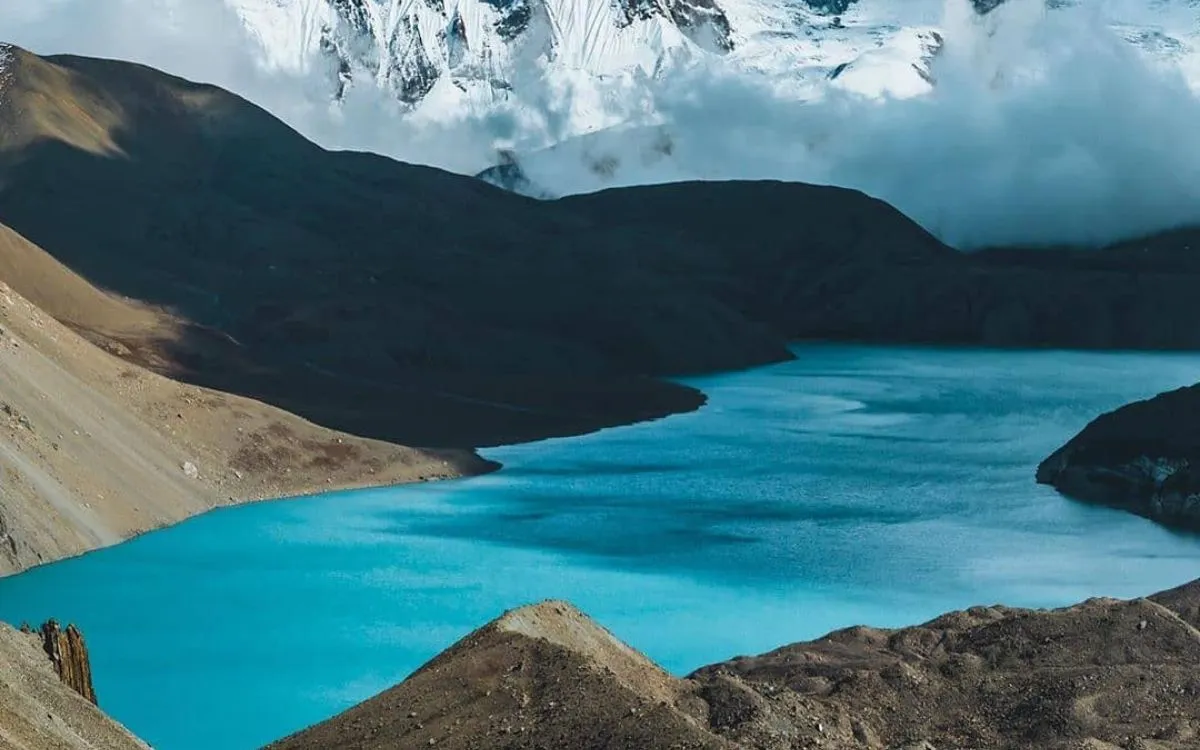
Mesokanto La Pass is located at 5,099 meters (16,729 ft) in the Annapurna region and is among the least known high passes in Nepal. It connects Tilicho Base Camp to Jomsom in the Kali Gandaki Valley, establishing a high-altitude linkage between very remote areas of the Annapurna Circuit. Trekkers normally approach the pass after visiting Tilicho Lake (which is one of the highest lakes in the world) so it is a really scenic and challenging trek.
When walking to Mesokanto La there are rocky paths, scree slopes and potentially snow, especially in the early spring or late autumn. The crossing is physically demanding, as trekkers will be navigating many long hours of uphill walking at high altitude, requiring stamina and accurate pacing. The climb requires no technical outdoor experience in terms of climbing, but because it is so remote, there are less trekkers in general than on the main Annapurna Circuit.
From the summit of the pass, trekkers are treated to expansive views of Tilicho Peak, Nilgiri, Dhaulagiri and the whole area surrounding them in the Himalaya. The descent down to Jomsom goes through dry valleys and small settlements, letting trekkers experience the local Thakali culture.
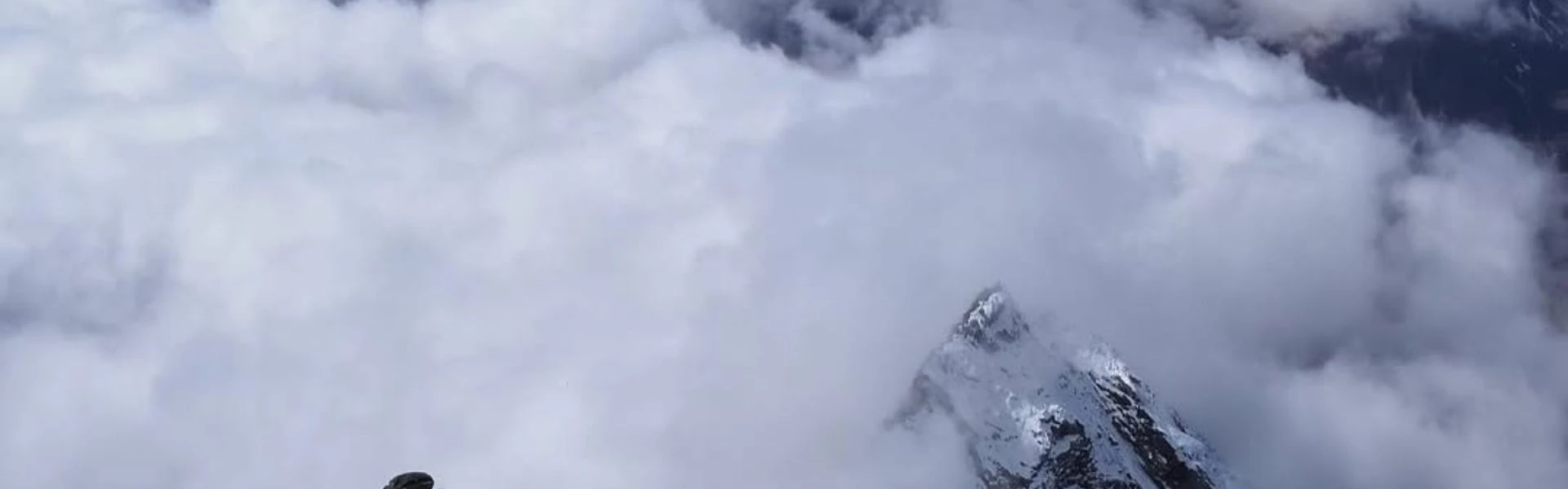
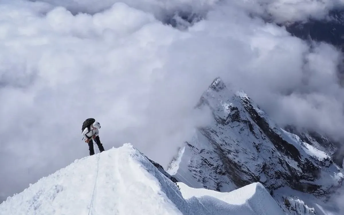
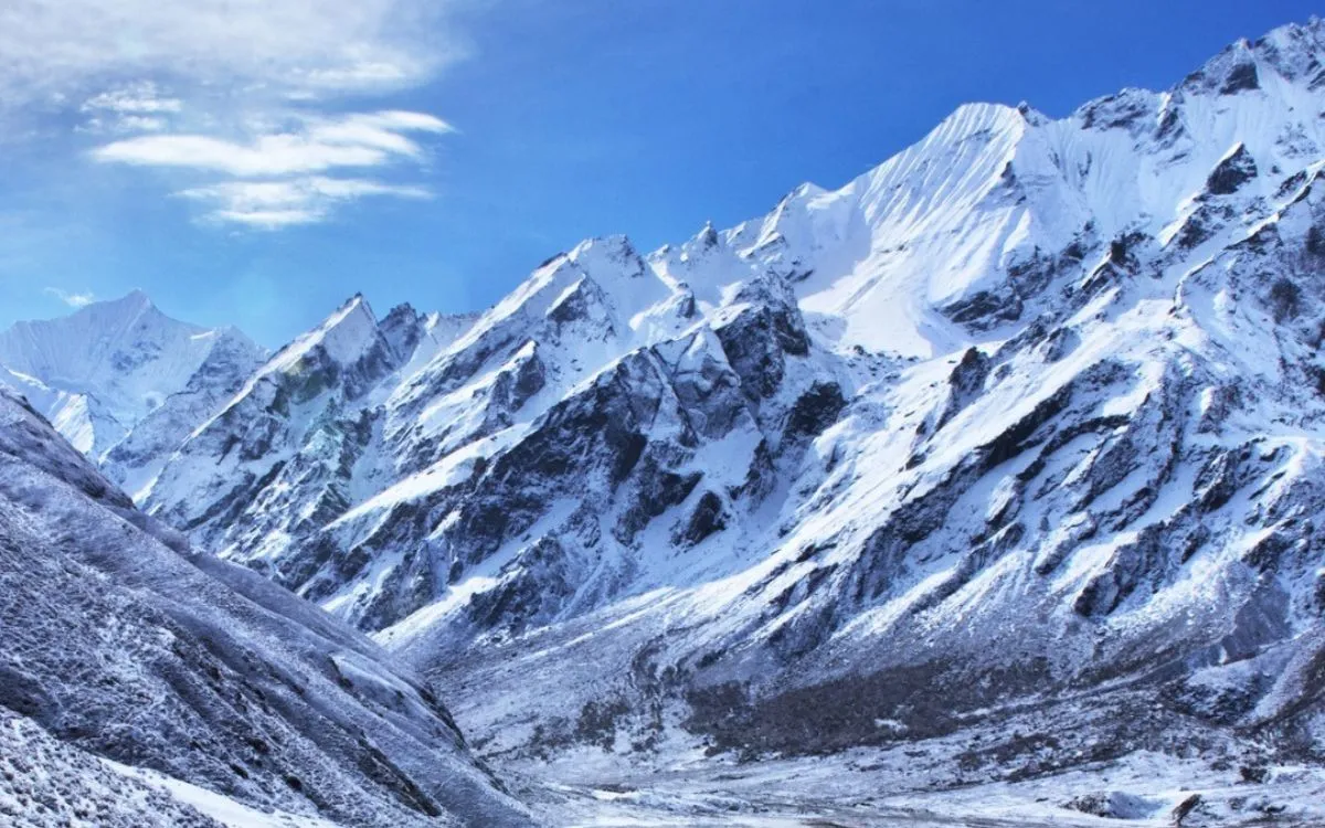
Tashi Labsta Pass – Rolwaling to Everest region
Altitude: 5,755 meters (18,881 ft)
Location: Dolakha and Solukhumbu districts
Starting Point: Beding (Rolwaling)
Ending Point: Thame (Everest)
Trekking Route: Rolwaling to Khumbu route
Difficulty: Very challenging, technical
Best Season: April to May, October to November
Caption
It is 5,755 meters (18,881 ft) and connects the remote Rolwaling Valley with the Everest region, linking Beding in Rolwaling to Thame, Khumbu Valley, presenting an ultimate trekking and climbing experience for all seasoned trekkers. It can be called a final challenge for trekkers in Rolwaling and Sagarmatha National Park, as it requires a journey through remote regions with breathtaking views before steep climbs, glacial moraines, ice crossings and rocky slopes. With spectacular scenery and remote, rugged terrain, Tashi Labsta offers a very unique high-altitude trekking experience, away from the busy and conventional Everest Base Camp route.
The trail to Tashi Labsta presents some steep climbs in a challenging landscape. There are glacial moraines, ice crossings, and rocky climbs to Tashi Labsta, so trekkers will need proper trekking gear, a high level of physical fitness and strong previous high-altitude trekking experience. There are no settlements at Tashi Labsta so trekkers will need to carry sufficient food, water and gear to cross.
When you reach the summit of Tashi Labsta you will see Mount Everest, Cho Oyu, Gaurishankar and other peaks in the Rolwaling and Khumbu mountains. The descent into Thame is pretty straight forward as you will pass through small Sherpa villages, giving you an opportunity to experience the local culture and stunning beautiful landscape of the Himalayas.
Kang La Pass – Annapurna region
Altitude: 5,320 meters (17,454 ft)
Location: Nar Phu Valley, Annapurna region
Starting Point: Phu Village
Ending Point: Ngawal (Manang)
Trekking Route: Nar Phu Valley Trek
Difficulty: Moderate to challenging
Best Season: March to May, September to November
Kang La Pass
The Kang La Pass (5,320m/17,454ft) connects the remote Nar Phu valley with Ngawal in the Manang Valley of the Annapurna region. This trek connects the traditional Tibetan influenced villages of Phu and Nar with the Annapurna trekking routes and provides an alternative route in less traveled areas for trekkers interested in high-altitude wilderness and solitude.
The trek to the Kang La Pass follows a steep uphill rocky, snow, or combination of both depending on the season, footpath. Most trekkers start from Phu village, crossing glacial moraine, path-less big boulder terrain, and rocky switchbacks to reach the pass. While non-technical, the crossing will require good physical fitness, careful pacing, and the necessary acclimatization considerations due to the altitude.
From the top trekkers will be afforded stunning views of the Annapurna II, Tilicho Peak, Gangapurna, and Nar Phu valley below. The descent into Ngawal offers more panoramic views of lush alpine valleys and traditional farming villages, and therefore trekkers are rewarded with many natural and cultural highlights all along the route.
Ganja La Pass – Langtang region
Altitude: 5,130 meters (16,831 ft)
Location: Langtang region, Rasuwa district
Starting Point: Kyanjin Gompa
Ending Point: Tarkeghyang
Trekking Route: Langtang Valley to Helambu
Difficulty: Challenging
Best Season: March to May, September to November
Ganja La Pass
Ganja La Pass is 5,130 meters (16,831 ft). The pass connects Langtang Valley with Helambu within the Rasuwa district of Nepal. The pass starts from near Kyanjin Gompa in Langtang, and descends into Tarkeghyang. This creates a high-altitude link between two areas with rich cultural, scenic, and trekking traditions. Trekkers typically undertake the pass after visiting Langtang Valley, which is filled with glaciers, alpine scenery, and traditional Tamang villages.
The hike to Ganja La is one of the more strenuous passes in Nepal as it involves rocky trails, steep ascents and snow-covered slopes. Trekkers require acclimatization, trekking gear and fitness to achieve a successful and safe crossing of the pass. The route is remote and camping is required in some areas because of non-existent lodges.
The panoramas from the top include Langtang Lirung, Dorje Lakpa, etc, with the descent into Helambu notable for beautiful forests, terraced fields and traditional villages. A combination of remote, rural scenery and cultural experiences.
Nyu La Pass – Mustang region
Altitude: 5,310 meters (17,421 ft)
Location: Upper Mustang, Mustang district
Starting Point: Ghami
Ending Point: Charang
Trekking Route: Upper Mustang Trek
Difficulty: Moderate
Best Season: March to May, September to November
The Nyu La Pass is located at 5310m (17421 ft) in Upper Mustang, located between the villages of Ghami and Charang. Nyu La is part of trekking routes in the limited area of Upper Mustang, which allows trekkers to experience the Tibetan influenced culture of the region, the ancient walled city of Lo Manthang in Mustang and the high-altitude desert land of Upper Mustang.
The trek to Nyu La involves moderate ascending over rocky, arid conditions. It does not feature glaciers or technical conditions like other high passes; however, altitude, higher winds in Mustang and other factors still require trekkers to have timely acclimatization, physical stamina, and warm gear. There are barren plateaus, red cliffs, and narrow valleys that emphasize the unique topography of this part of Nepal.
From the top, trekkers can see a good fraction of the surrounding peaks including Nilgiri and Annapurna, and then the Mustang plateau drops below. After edging toward Nyu La Pass, trekkers descend into traditional villages full of flat-roof houses and prayer wheels.
FAQs
What are the highest mountain passes in Nepal?
Nepal is home to high passes above 5,000 meters, including Kongma La, Cho La, Renjo La, Thorong La, Larkya La, Mesokanto La, Tashi Labsta, Kang La, Ganja La, and Nyu La. The passes connect valleys, trekking trails, and isolated villages across the Himalayas.
Which Nepal trekking passes are part of the Everest Three Pass Trek?
The Everest Three Pass Trek includes Renjo La, Cho La, and Kongma La, which connect Gokyo, Dzongla, Chhukung, and Lobuche. These passes offer spectacular views of Everest and many other important peaks in the area, including Lhotse and Ama Dablam.
What is the best time to trek high passes in Nepal?
The best time to trek in the high passes in Nepal is in spring (March to May) and in the fall (September to November), when the weather is most stable, skies are clear, and snow is at a level that allows for snow-free trekking routes through the high passes.
How difficult are the high passes in Nepal?
The difficulty of the passes range from moderate to very challenging. Thorong La and Renjo La have moderate difficulty levels, and require basic acclimatization and fitness. Kongma La and Tashi Labsta are more technical obstacles, requiring advanced fitness levels and acclimatization.
Do I need a guide or porter to cross Nepal’s high passes?
It is strongly advised to hire either a guide or a porter, especially with the more remote and technical passes. Guides assist with navigation, safety and cultural appreciation. Porters take the load off your shoulders (literally) on longer treks.
What mountains can I see from these high passes?
Depending on the region, you are bound to see iconic peaks including Mount Everest, Lhotse, Makalu, Cho Oyu, Annapurna II, Dhaulagiri, Himlung Himal, and Ama Dablam from these passes.
How long does it take to cross passes like Thorong La or Larkya La?
You will generally need the whole day to cross a pass, 6 - 10 hours, depending on your fitness, weather conditions and altitude acclimatization. Certain passes may require you to leave in the early morning to avoid traversing snow or ice.
Conclusion
Nepal contains some of the highest and most stunning mountain passes in the world, giving trekkers unforgettable trekking experiences of Himalayan scenery, culture, and adventure. From the Everest Three Pass Trek, including Cho La Pass, Renjo La Pass, and Kongma La Pass, to high passes in the Annapurna, Manaslu, Langtang, and Mustang regions, each pass makes an extraordinary connection between valleys, villages, and trekking routes, and provides many unique exploration opportunities.
The trekking passes in Nepal appeal to moderate to challenging trekkers, while offering spectacular, panoramic perspectives of the most iconic mountains, glaciers, and remote cultural villages. Crossing high passes in Nepal is a rewarding adventure for experienced trekkers, and inspiring experience for aspiring trekkers.
If you want help planning your trek or want more information about the top 10 highest mountain passes in Nepal contact Himalayan Recreation.
-3.webp)
-2.webp)
-4.webp)