Have you ever wondered where is Nepal located? — The answer lies in the heart of Asia. Nepal is a landlocked country nestled in the lap of the mighty Himalayas, positioned in South Asia between the two giants of the continent: India and China. Sitting at the crossroads of ancient civilizations and breathtaking natural landscapes, Nepal's location on the world map makes it one of the most geographically fascinating nations on Earth. From the snow-capped peaks of the Himalayan range to the lush, subtropical plains of the Terai, this small yet mighty country offers an extraordinary range of terrain.
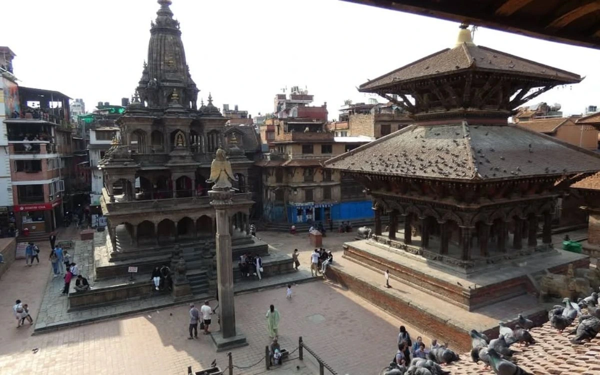
Ancient Hindu temples and a stone pillar at Patan Durbar Square in Lalitpur, Nepal
Nepal's location spans from approximately 26°N to 30°N latitude and 80°E to 88°E longitude. Whether you search for Nepal map location, explore its borders, or dive into its geography, one thing is clear: Nepal is a place where adventure meets culture, and nature meets history. For travelers passionate about the mountains, trekking in Nepal remains the ultimate bucket-list experience.
Nepal Location on the World Map
Nepal lies within Asia, specifically in South Asia, as part of the Asian continent. On a world map, you will find that Nepal is a rectangle running from west to east and bordered by Tibet (China) to the north and by India to the east, west, and south. The latitude/longitude of Nepal’s geographical center is 26.3978° N and 87.3240° E, and its land area is estimated to be around 147,181 square kilometers, which is equivalent to about the size of Arkansas (USA). Although a relatively small country, Nepal’s diversity of terrain ranges from the very highest peaks in the world to lowland floodplains with rich agricultural land.
The most symbolic destination for trekkers/mountaineers travelling from this area is the Everest Base Camp Trek, which takes you to the base camp of Mount Everest. You will start your trek (the EBC Trek) in Lukla in northeastern Nepal, and you’ll pass through Sherpa communities (villages), monasteries (Buddhist), glaciers (high altitude), all of which lead you to the EBC, which is located at an elevation of approximately 5,364 meters above sea level.
Which Continent is Nepal In?
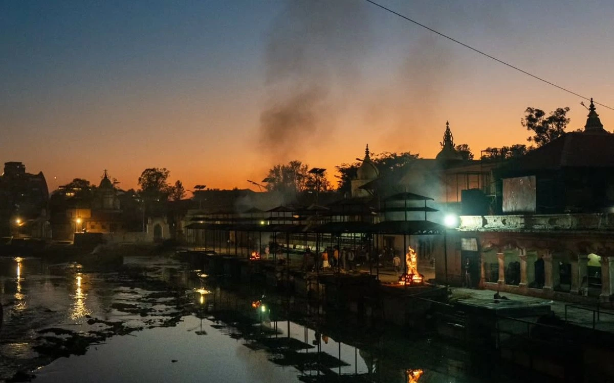
Cremation fires and smoke rising at the Pashupatinath Temple ghats along the Bagmati River at dusk
Nepal is located in Asia, specifically, it can be found in South Asia. Other countries in the South Asian region are India, Bangladesh, Bhutan, Sri Lanka, Pakistan, the Maldives, and Afghanistan. As a member of SAARC (South Asian Association for Regional Cooperation) (SAARC), Nepal has deep roots in the South Asian geopolitical and cultural sphere.
Nepal also holds an exceptional geographic position within Asia. It is the one country in the entire world that exists entirely within the boundaries of the Himalayan mountain range on one side, while it borders the vast Indian subcontinent on the other side. This dual geographical identity has resulted in Nepal having a wide variety of biological diversity as well as a multitude of cultural richness and importance in the region.
Nepal Between India and China
Historically, being located between two of the world’s most populous countries, India and China, is an important aspect of Nepal’s geography. Being located in the center between two major Asian powers has influenced Nepal’s culture, history, trade routes, and foreign policy for centuries, and continues to be the case today.
Immediately to the north, Nepal borders China (the Tibet Autonomous Region). The Great Himalayas separate China from Nepal, with such high mountain passes as Rasuwagadhi and Tatopani providing access for both trade and travel. On three sides (south, east, and west), Nepal shares a border with India. The open border we share with India allows the free movement of people and goods across the border due to the mutually shared cultural and economic ties that exist between the two countries.
Because of its location at the convergence point of two major Asian nations, Nepal has been of interest to the international community for centuries and continues to be a point of geopolitical interest in today’s world. Being located between India and China also gives Nepal access to some of the best trekking areas in the whole world. For example, the Annapurna Circuit Trek takes trekkers around the Annapurna Massif (the area surrounding Annapurna I, the 10th highest mountain in the world), through different ethnic communities, subtropical forests, and alpine meadows. The trek also goes over Thorong La Pass at an elevation of 5,416 metres — one of the highest trekking passes in the world.
Countries Bordering Nepal
Nepal shares its borders with only two countries:
1. India — Nepal shares approximately 1,770 km of open border with India. The Indian states of Uttarakhand, Uttar Pradesh, Bihar, West Bengal, and Sikkim all share boundaries with Nepal.
2. China (Tibet) — Nepal shares approximately 1,389 km of border with the Tibet Autonomous Region of China along the northern Himalayan frontier.
Nepal does not share a border with Bangladesh or Bhutan, though these countries are geographically close. The narrow Siliguri Corridor — often called the "Chicken's Neck" — separates Nepal from Bangladesh and Bhutan to the east.
Geographic Regions of Nepal
Nepal's geography is divided into three distinct ecological and altitude-based zones, each with its own character, climate, and opportunities for exploration.
Himalayan Region
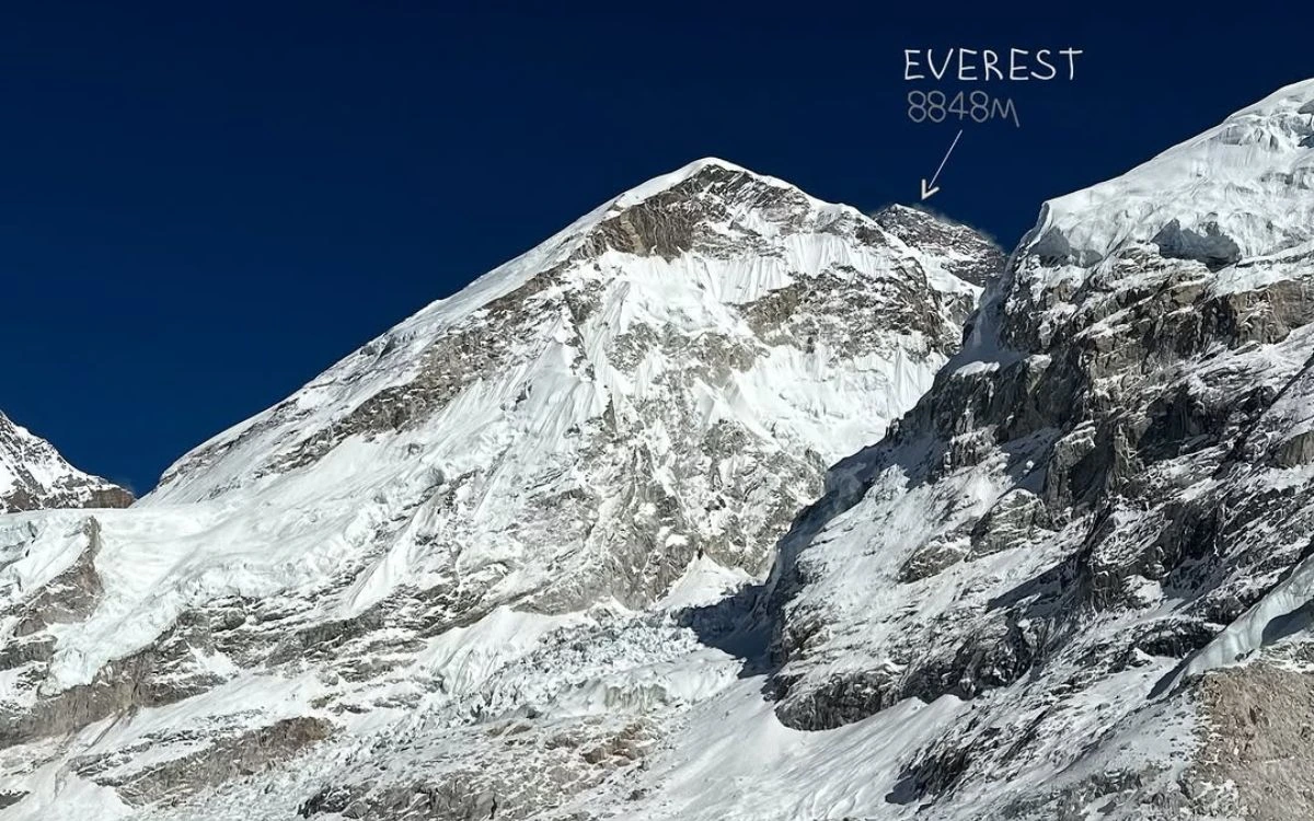
Mount Everest summit at 8,848m labeled on a close-up photo taken from Everest Base Camp
Nepal's northernmost region, where the Himalayas contain some astonishing peaks, lies in the Himalayas. This remote area, above 4,000 meters above sea level, features 8 of the 14 known 8,000-meter peaks in the world. These include Everest (8,848.86m), Kangchenjunga, Lhotse, Makalu, Cho Oyu, Dhaulagiri, Manaslu, and Annapurna.
Most of these alone, while the population is low because of the harshness of the northern areas, are of Tibetan descent (Sherpa, Tamang, or Loba). Most of the area has no agriculture due to the harshness of the conditions, but it is home to thousands of trekkers and climbers each year.
For those who wish to experience a unique area in the incomparable Himalayas, the Upper Mustang is an incredibly distinctive location. Once a "forbidden" kingdom, at the foot of the Annapurna and Dhaulagiri ranges, Upper Mustang is in the rain shadow of these two great ranges and has an arid, Tibetan-influenced landscape and many preserved monasteries with a heritage that dates back to the Middle Ages.
Hilly Region
The Hilly/Pahad Region is part of the land between the Himalayas and the Terai, occupying the elevation band of a little under 2,000 ft to 12,000 ft in elevation (about 600m to 4,000m). This region has the most population density of any part of Nepal and contains the Kathmandu Valley – the political, cultural, and economic centre of Nepal.
Terrain in the hilly region varies considerably, featuring fertile river valleys, terraced agricultural systems, and dense rhododendron forests. Major cities, including Kathmandu, Pokhara, and Chitwan, are located in or directly adjacent to the hilly region. The diverse ethnic groups of Nepal, which include the Newars, Gurungs, Magars, and Rais, have all settled in these hills over a long history.
Many trekkers will choose to follow the Langtang Valley Trek, which is located immediately north of Kathmandu and offers excellent views of the Himalayas, numerous Tamang villages, and the strikingly beautiful Gosaikunda Lake. The proximity of these sights to Kathmandu makes them logical choices for both short and long-distance treks.
Terai Region
Nepal’s Terai Region is the southernmost lowland of the country. This flatland is mainly found between the Indian states of Uttar Pradesh and Bihar to the east and west, respectively,y and forms the boundary of Nepal.
The Terai’s elevation varies from 60 to 300 meters above sea level and is considered one of the most important agricultural areas in Nepal.
Within the Terai are many national parks and wildlife reserves, including Chitwan National Park and Bardia National Park, where one can see one-horned rhinoceros, Bengal tigers, gharial crocodiles, and the largest concentration of bird species in Nepal. The cities of Birgunj, Janakpu,r and Dhangadhi are the main economic and cultural centers of the Terai.
Latitude, Longitude, and Total Area of Nepal
Geographic Detail
Data
Location
South Asia
Latitude Range
26°N to 30°N
Longitude Range
80°E to 88°E
Total Area
147,181 sq km
Border with India
~1,770 km
Border with China
~1,389 km
Highest Point
Mount Everest (8,848.86 m)
Lowest Point
Kechana Kalan (59 m)
Where is Mount Everest Located in Nepal?
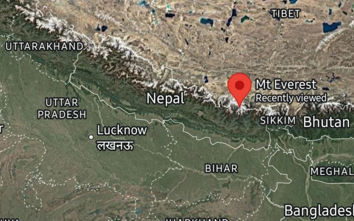
Satellite map showing Nepal's location between India and Tibet with a pin marking Mount Everest
Mount Everest (8,848.86 meters/29,031.7 feet), the tallest mountain in the world, is situated in the Khumbu Region of northeastern Nepal, located in the Solukhumbu District of Sagarmatha Province. The mountain sits on the border of Nepal and Tibet (China); therefore, it is referred to as Sagarmatha (meaning sky goddess) in Nepal and Chomolungma in Tibet.
The Solukhumbu Region, where Mount Everest is located, is also home to the Sherpa people, a well-known group of skilled mountaineers. The closest town to Everest is Namche Bazaar, which is a primary supply point for climbers and trekkers going to Mount Everest and is the gateway to the Khumbu Valley.
Another popular trekking option that provides an alternative to the Base Camp trek for Mount Everest is the ABC (Annapurna Base Camp Trek), which is shorter but just as breathtaking as the trek to EBC. The ABC trek takes you through incredible rhododendron forests, a terraced Gurung village,s and up to the Annapurna Base Camp (which is the base camp for 13 peaks 6,000+m).
The capital of Nepal, Kathmandu, is the biggest city in Nepal. Kathmandu is located at an elevation of about 1,400 m in the Kathmandu Valley and is considered the centre of Nepal inregard too politics, culture, commerce, and tourism. Kathmandu has seven UNESCO World Heritage Sites: Pashupatinath Temple, Boudhanath Stupa, and Swayambhunath – The Monkey Tem,ple etc.
Other major cities include:
Pokhara — Nepal's second-largest city, serving as the gateway to the Annapurna region.
Lalitpur (Patan) — Known for its rich Newar heritage and stunning Durbar Square.
Bharatpur — The gateway to Chitwan National Park in the Terai.
Biratnagar — Nepal's industrial capital, located in the eastern Terai.
Why Nepal's Geographic Location is Important
The nation of Nepal is geographically positioned between India to its south and China to its north. This positioning gives Nepal immense strategic importance as a buffer state situated between two nuclear-armed countries having histories of tense relations. Thus, Nepal has to carefully balance its foreign policy between these two states, plus all other states in the region.
Nepal's geographic location facilitates regional trade between South Asia and East Asia via the multiple centuries-old trade routes that pass through its mountainous terrain.
From an ecological perspective, the country possesses an enormous array of natural biodiversity. The five climate zones in Nepal (including tropical in the Terai and arctic in the Himalayas) allow for various flora and fauna (including rare species) to exist there, such as the snow leopard, red panda, one-horned rhinoceros, and over 900 types of birds.
The global trekking/mountaineering community views Nepal's geography as an awe-inspiring location with eight of the world's fourteen 8,000-meter peaks and hundreds of other lower but equally beautiful summits. Because of this, it is the ultimate destination for those interested in outdoor adventures, nature, and spirituality.
Climate and Landscape of Nepal
Nepal has a lot of differences between its regions in terms of the weather and climate, and the main factor that determines the difference is how high above sea level you are. The Terai region will have more hot summers and mild winters, whereas the Hilly region will have summer and winter days that are cool at the higher elevations but temperate at the lower elevations. However, if you are in the Himalayan region, the climate will be alpine to tundra, with very cold temperatures and heavy snow during the winter months.
The four seasons of Nepal include spring (March through May), summer and monsoon (June through September), fall (October and November), and winter (December through February). The spring and fall are the prime seasons for trekking and climbing in the country due to clear skies and comfortable temperatures.
Nepal's diverse landscape of jungle and bare desert creates stunning vistas that bring tourists to the country from all over the world. The young and ever-growing Himalayas are helping to shape Nepal's landscape; the Indian tectonic plate continues to move northward against the Eurasian plate, forcing it to rise at a rate of a few millimeters each year.
How to Reach Nepal from Different Countries
Most people arriving in Nepal use Tribhuvan International Airport (TIA), located in Kathmandu, as their primary entry point into Nepal because there are many direct flights to/from TIA from major international airports throughout Asia, the Middle East, and South Asia, including airports in Delhi, Mumbai, Dubai, Doha, Bangkok, Singapore, and many cities across China.
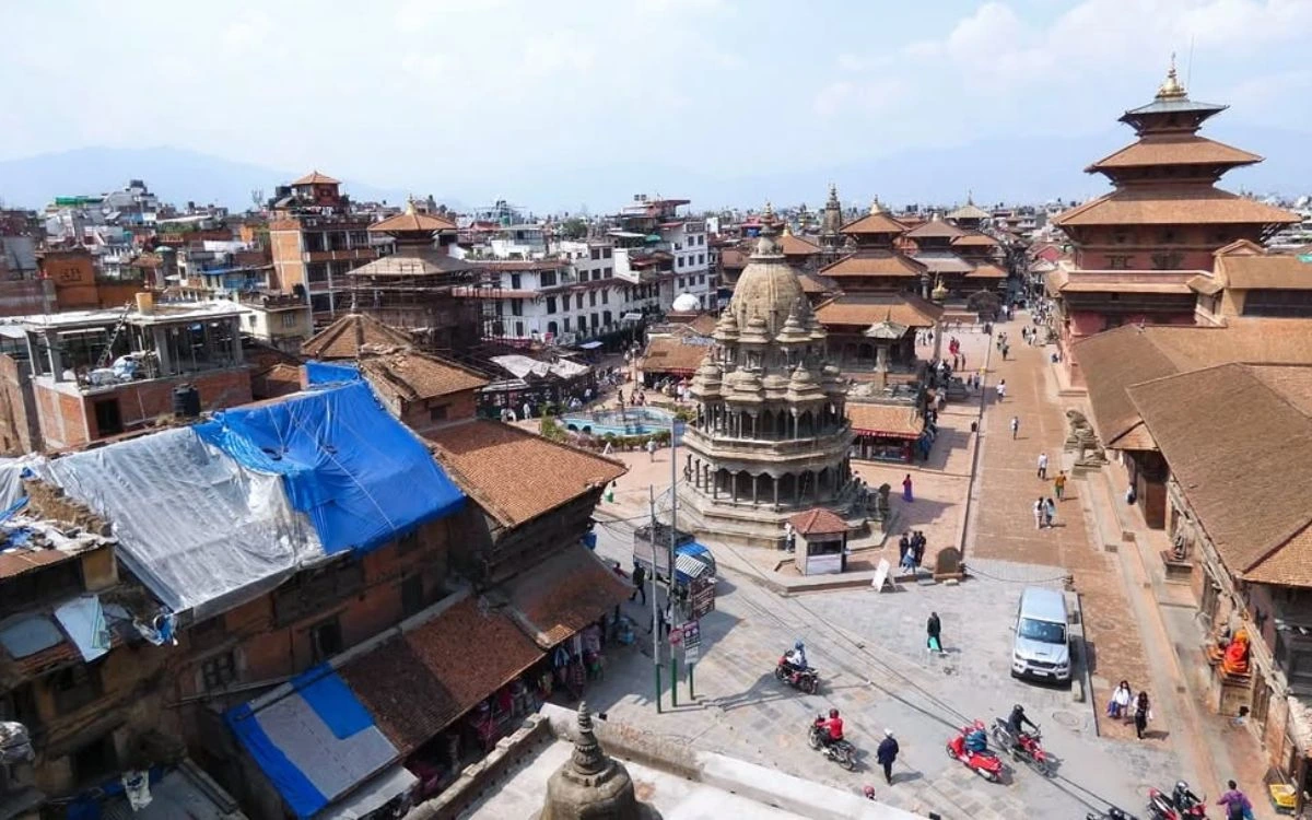
Aerial view of Patan Durbar Square with ornate pagoda temples, brick streets, and the city of Lalitpur
Other ways to enter Nepal from India are through border crossings, such as Kakarbhitta (east), Birgunj (central), Bhairahawa (Sidharth Nagar), and Mahendranagar (west). One of the most popular border crossings from Tibet (China) into Nepal is Rasuwagadhi – Kerung, which is used for trade and tourism.
Nepal does not currently have a rail system, yet there are plans to continue to increase the number and quality of existing road connections between all parts of Nepal. In addition, the government is building new highways between major cities and remote locations.
Interesting Facts About Nepal's Geography
• Nepal contains 8 of the world's 14 highest peaks, all above 8,000 meters.
• Nepal is a landlocked country — it has no access to the sea or ocean.
• Nepal is home to the world's deepest gorge — the Kali Gandaki Gorge — which is deeper than the Grand Canyon.
• The elevation in Nepal ranges from 59 meters (Kechana Kalan) to 8,848.86 meters (Everest) — one of the greatest elevation ranges of any country.
• Nepal has over 6,000 rivers and rivulets, all originating from the Himalayan glaciers.
• Despite its small size, Nepal is home to more than 100 ethnic groups and over 120 languages.
Frequently Asked Questions About Nepal's Location
What region of the world is Nepal located in?
Nepal is located in South Asia, on the southern side of the Himalayas. It has land borders with China on the north, and with India on the south, east,t and west.
Is Nepal part of India?
No. Nepal is a completely independent country and has its own government, constitution, and national identity. Nepal has a long and open border with India, and is culturally close to India, but is an independent country.
What is the location of Nepal in the world?
Nepal is located in South Asia, between 26 and 30 degrees North Latitude and 80 and 88 degrees East Longitude. It is a landlocked country and is located between China and India.
How far away is Nepal from the ocean?
Nepal is a landlocked country and does not directly touch the ocean. The nearest coastline to Nepal is the Bay of Bengal, which is located about 700 km southeast of Nepal through Bangladesh or India.
Which hemisphere is Nepal in?
Nepal is located in the Northern Hemisphere and the Eastern Hemisphere.
Conclusion
The geographical location of Nepal is remarkable. It is located between India and China, in the centre of the Himalayas, and includes five different climate zones. This means that there are so many different variations in Nepal's geographic and natural environments that you will be astounded at every turn. The geography of Nepal creates an incredible story of diversity and natural wonder from the ancient temples of Kathmandu, the top of Mount Everest, the lush jungles of the Terai, to the wind-swept high plateaus of Upper Mustang.
Whether you are a geography buff seeking to see the geographic location of Nepal on the globe, a traveller planning your first trip to Nepal, or an experienced mountaineer chasing your dream summit, there are so many remarkable things for you to see and do in Nepal. The first step to falling in love with Nepal is learning where it is located and why the geographic location of Nepal is so important.
Are you ready to experience the mountains for yourself? Himalayan Recreation Treks and Expeditions would be your partner of choice in having unforgettable trekking, climbing, and adventure experiences in Nepal.
.webp)
-2.webp)
-3.webp)
-4.webp)